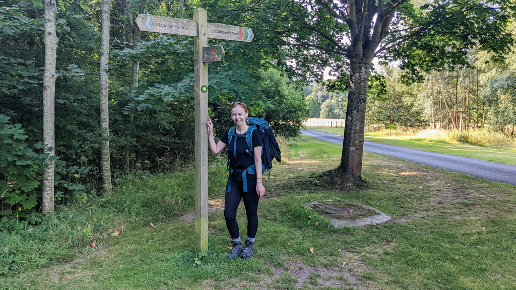
St Cuthbert’s Way Walk Guide: My Experience Hiking to Lindisfarne

Offscreen Tourist posts contain affiliate links. If you make a purchase using one of these links, I may receive compensation at no extra cost to you. See the disclaimer here for more information.
There are 16 National Trails in England and Wales, including Hadrian’s Wall Walk. There are 29 Great Trails in Scotland and countless other long-distance walks, trails, hikes and pilgrimages across the United Kingdom. In August 2022, a pal and I decided to walk St Cuthbert’s Way, out of all the possible trails we could have chosen.
You’ve either found this post because you’re interested in walking St Cuthbert’s Way or you’re a loved one of mine. If it’s the former, you might be thinking, “What a great choice you made!” And if it’s the latter, you might be thinking, “Eh?”

St Cuthbert is not a very well-known saint outside of the Scottish Borders and the county of Northumberland in England. His pilgrimage route is even lesser known. But the St Cuthbert’s Way Walk is one of the only long-distance walks in Scotland and England. It also features diverse terrain up steep inclines, along rolling hills of Northumberland National Park, through tiny villages and open cattle farms.
We chose to do this walk because my pal wanted to see St Cuthbert’s Lindisfarne island where this pilgrimage ends. And what better way to visit the island for the first time than at the end of a multi-day hike? We started our planning at the end of May and, two and a half months later, we set off.
There aren’t many first-hand accounts of people who’ve completed St Cuthbert’s Way online which can be so helpful for people venturing into these challenges. So, this is my experience walking St Cuthbert’s Way featuring our itinerary, accommodation, and other essential tips. Feel free to ask me questions in the comments at the end of this post!
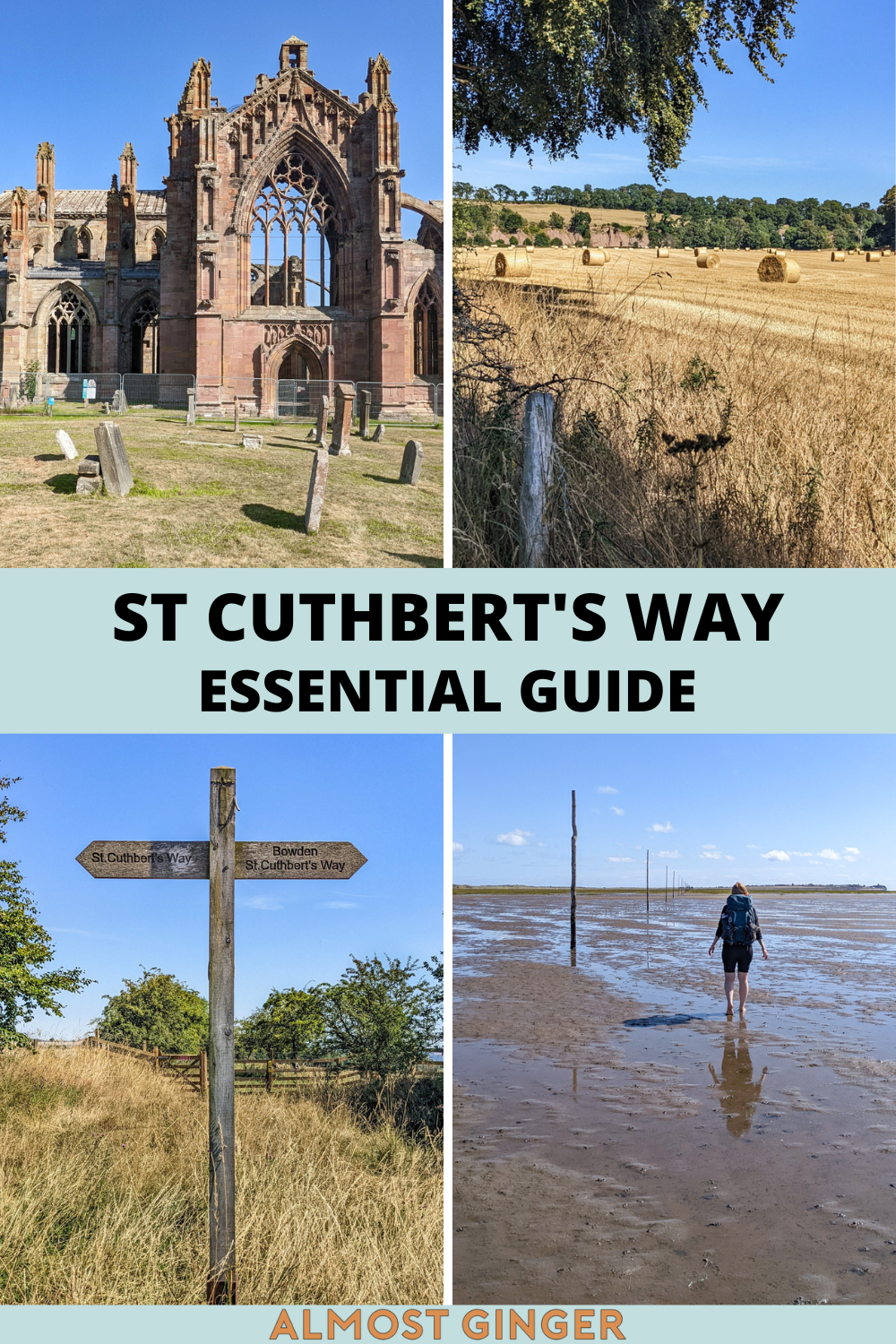
Hiking St Cuthbert’s Way From Melrose to Lindisfarne

What Is St Cuthbert’s Way and Where Is It?
St Cuthbert was a bishop, monk and hermit who lived from 634 to 687 AD. He’s one of the most important medieval saints of Celtic tradition and grew up near the Old Melrose Abbey in Lauderdale. He decided to become a monk after he had a vision of St Aidan (an Irish monk who founded the Priory on Lindisfarne).
In 662, he became the Prior of Melrose Abbey. And in 665, he travelled to Lindisfarne to be the Prior there. The Way honours the journey he made from Melrose in the Scottish Borders to Lindisfarne in Northumberland, England. He prefered the solitude on Lindisfarne and it helped him feel closer to God. He wanted his grave to be on the island but he now rests in Durham Cathedral.
Lindisfarne is an island off the coast of England (only around 15-20 miles south of the Scottish border). Its other name, Holy Island, is because it was such an important place in early English Christianity thanks to people like Cuthbert and Aidan. St Cuthbert’s Island is a lesser-used moniker. It’s an inhabited island but only accessible during low tide. At high tide, the causeway is completely shut off to cars and walkers.

How Long Is St Cuthbert’s Way?
It stretches 62.5 miles (or 100km) between Melrose and Lindisfarne. People complete the walk in either four, five or six days. We decided to tackle the walk on hard mode and finish it in four days. We only walked the last few miles to Lindisfarne on Day Five because of the tide times.
Unlike Hadrian’s Wall Path, there is an accepted direction for this pilgrimage. Most walkers start at Melrose and end at Lindisfarne to follow in St Cuthbert’s footsteps. But the signs do point in the opposite direction if you’re dead set on walking it that way.

St Cuthbert’s Way Walk Itinerary: Five Days and Four Nights
You likely won’t stay in the exact same accommodations as we did or take the same journey before and after the walk. But I’ve provided a brief overview of our movements each day. Hopefully, my account will help you visualise how you might complete your own version of one of the most beautiful walks in the Scottish Borders.
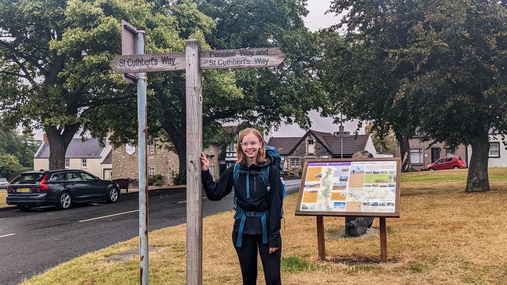
How to Get to Melrose Abbey
My friend and I were staying in Edinburgh before the walk. We decided to save on accommodation by waking up bright and early on a Saturday morning to travel from the Scottish capital to Melrose on Day One of this walk. Definitely doable with a bit of forward planning.
We caught a train from Edinburgh Waverley Railway Station to Galashiels which is a one-hour journey. Opposite Galashiels train station is the Galashiels Bus Station where we hopped on the N.61 bus to Melrose which is a 20-minute ride. You can buy your bus ticket from the driver via a contactless card. Quite straight forward and the bus stops right outside the Melrose Abbey Car Park which is the start of the walk!
I planned this journey using Google Maps and the suggested bus and train times were both 100% accurate.

Day 1: Melrose Abbey to Harestanes/Jedburgh (15 Miles)
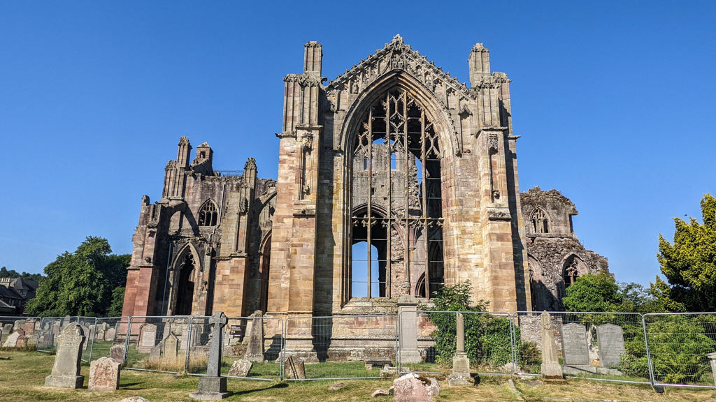
We made sure to arrive in Melrose just before Melrose Abbey opened at 10:00. It’s run by Historic Scotland so, thanks to our English Heritage membership cards which we bought for Hadrian’s Wall Walk, our tickets were half price. The abbey isn’t old enough to be the abbey that Cuthbert would have known, but it’s still worth exploring it before you leave.
I won’t lie to you, the second-largest incline of the walk hits you as soon as you begin. We started on a very hot August day and it was brutal. I thought about quitting the walk there and then because how was I going to finish 62.5 miles if I couldn’t even get up the first (albeit very steep and high) hill?!
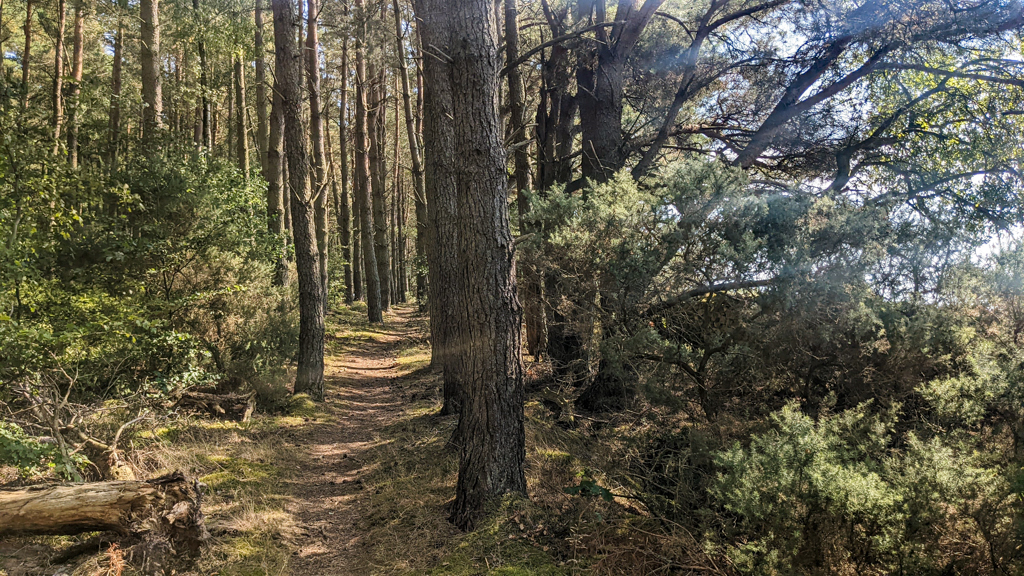
Luckily, I persisted. There are lots of shady wooded areas in this section and you follow the River Tweed for a while too with some lovely views. After lunch, we made a short detour to Dryburgh Abbey and visited Sir Walter Scott’s grave. There’s also a co-op in Newton St Boswells if you need to buy food.
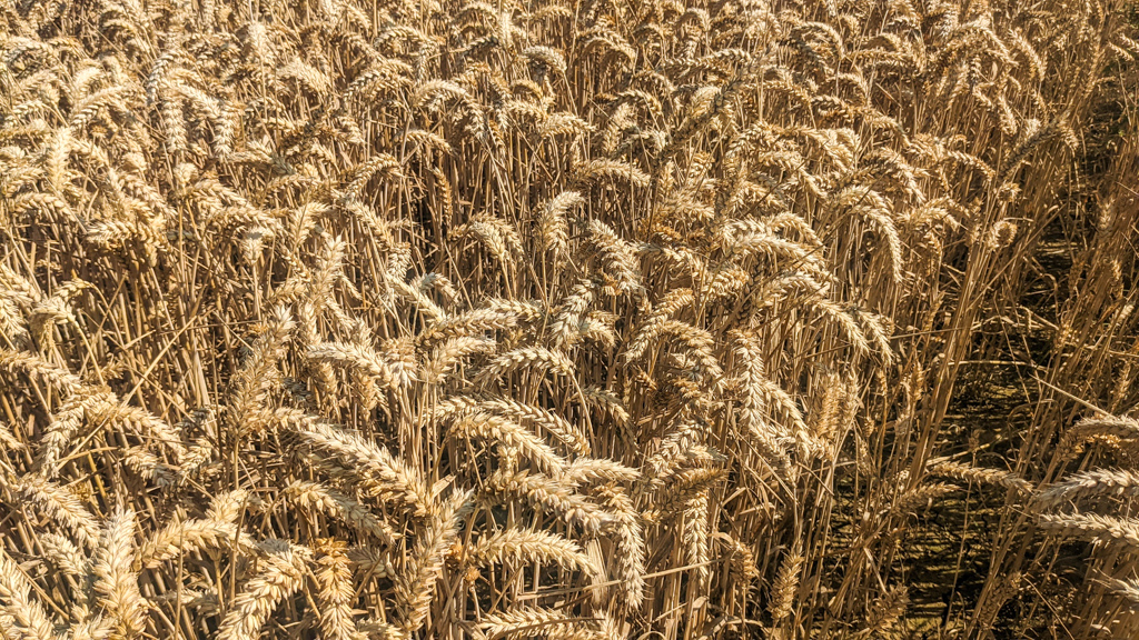
After a lot of road walking and strides through thick meadows of unharvested wheat, we reached the end of our section. The guidebook recommends finishing at Harestanes if you’re completing the walk in four days. Well, there’s nothing at Harestanes. We booked accommodation in Jedburgh.
Buses leave the South Myrescroft bus stop in Ancrum once an hour and we’d just missed one, so we had a long deflated wait ahead. Luckily, the bus journey to Jedburgh is only four miles and takes 10 minutes.
We managed to catch a glimpse of the beautiful Jedburgh Abbey around sunset from outside the fence. There are other Scottish Borders walks, like the Borders Abbey Way, that allows you to visit four abbeys in the Borders. I feel lucky we saw three!


Day 2: Harestanes/Jedburgh to Kirk Yetholm (16.5 Miles)
We hopped on the first bus leaving Jedburgh to where we’d left the trail the day before. Again, you can pay via a contactless card on all these buses.
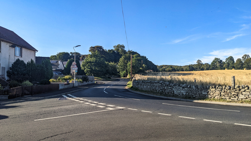
Even hotter than the day before (we were knocking on the door of 30°C), this section was gruelling at times. We had much less woodland coverage than on Day One and it seemed like the hills were even more unrelenting. There was a lot of road walking through villages like Morebattle (and a place called Cowbog! What a name!) and, of course, it was our longest day of the pilgrimage. Morebattle has a small convenience store if you need it.
But the toughest part of the whole walk was towards the end of this section, at the halfway point of the trail. It also happens to be the highest point of the trail too. Wideopen Hill is 368m tall and it is steep AF. No meandering, gentle sloping paths to the top. You just have to walk straight up there. In the heat, having already walked for miles, I was not having a good time and had to take breaks very often.
But somehow, we made it to Kirk Yetholm! And once I’d passed the halfway mark, I knew quitting was not an option. I’m so thankful that the accommodation for the rest of our trip was mere metres away from the trail. It really makes all the difference and I strongly suggest not booking accommodation off the trail if you don’t really have to.


Day 3: Kirk Yetholm to Wooler (13 Miles)
With a shorter walking day ahead of us and much cooler weather, we greeted Day Three with uplifted spirits. This section of the walk takes you across the Scotland – England border, through the Northumberland National Park, and not much else.
The guidebooks and people we spoke to all seem to agree that this is the toughest section of the walk. After all, you’re walking almost exclusively through hills. But since the first half of our pilgrimage was so challenging in the baking sun, this misty day was a treat! None of the hills felt oppressively steep, the soft paths were easy on our feet, and the scenery was pretty.
Because we walked in August, we were able to enjoy the purple blush of heather on the rolling hills stretching into the distance. It smelled, and looked, so beautiful. We also saw more people walking on this day than any other. Not necessarily walking the St Cuthbert’s Way path, just in general.
We wandered into Wooler into the alarmingly early time of 16:00. Thanks to our 9:00 start and the fewer miles we had to walk, we were able to wrap up at a decent time. I’d packed George Orwell’s Animal Farm (thanks to it being a very short and light book) and I was able to finish it over these last two evenings.


Day 4: Wooler to Beal (12.5 Miles)
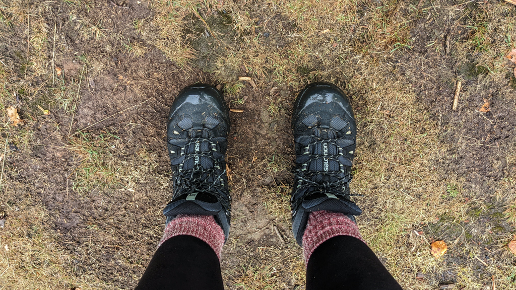
The weather forecast predicted rain for the last two full days of our walk so we were grateful to not experience any on Day Three. On Day Four, we would not be so lucky. We felt cold most of the day. Not just because of the wet winds whipping us in the face, but because trudging through the long grass instantly soaked our supposedly waterproof boots.
It reached a high of 13°C on the day we walked this section. Quite a stark difference to the 30°C two days prior!
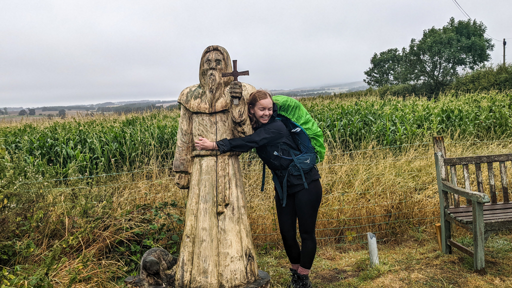
There are some more “attractions” to see in this section if you could call them that. There’s a wooden statue of St Cuthbert right on the trail itself (you can’t miss it) accompanied by a small beaver. St Cuthbert adored animals, so that explains that.
You also join the St Cuthbert’s Cave walk in this section too. The cave (also known as Cuddy’s Cave) is an overhang of sandstone rock. Legend says St Cuthbert took shelter here during his walk to Lindisfarne. His followers carried his body back here after he died too.
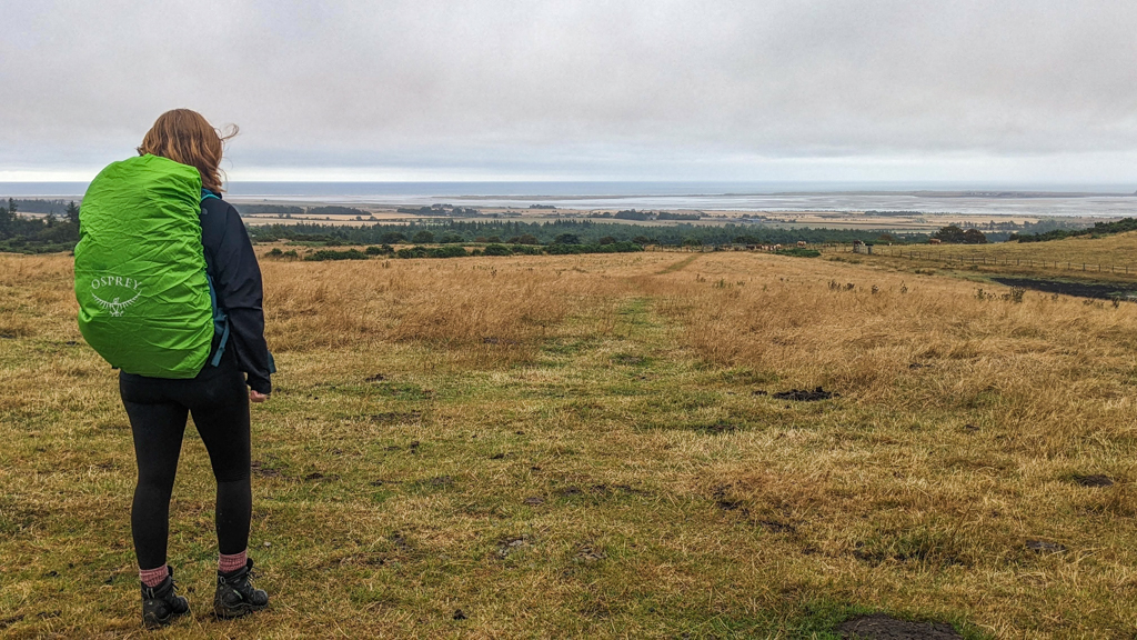
Just as our feet were really starting to get uncomfortable due to our soaking wet socks and boots, we reached the top of a small hill and looked out over the sea to Lindisfarne. It, quite literally, stopped us in our tracks.
From there, we pressed on through the Kyloe Wood to Beal. It’s the closest we could stay to Lindisfarne since the tide times meant there was no way we could cross on day four. It was probably for the best as we desperately needed to dry off! But what else did we expect venturing on long walks in Scotland and Northern England?!
Read next: Hadrian’s Wall Accommodation Guide: B&Bs, Bunkhouses & Campsites


Day 5: Beal to Lindisfarne/Holy Island (5.5 Miles)
On the day we crossed the sea to Lindisfarne, low tide was between 10:45 and 17:45. You can find the safe causeway crossing times on Northumberland County Council’s website. They’re available very far in advance.
But we knew these safe crossing times are for the road causeway where cars, cyclists, and road walkers reach the island by asphalt. And my pal and I didn’t want to walk along the causeway. We wanted to cross into Lindisfarne via the Pilgrim’s Path.
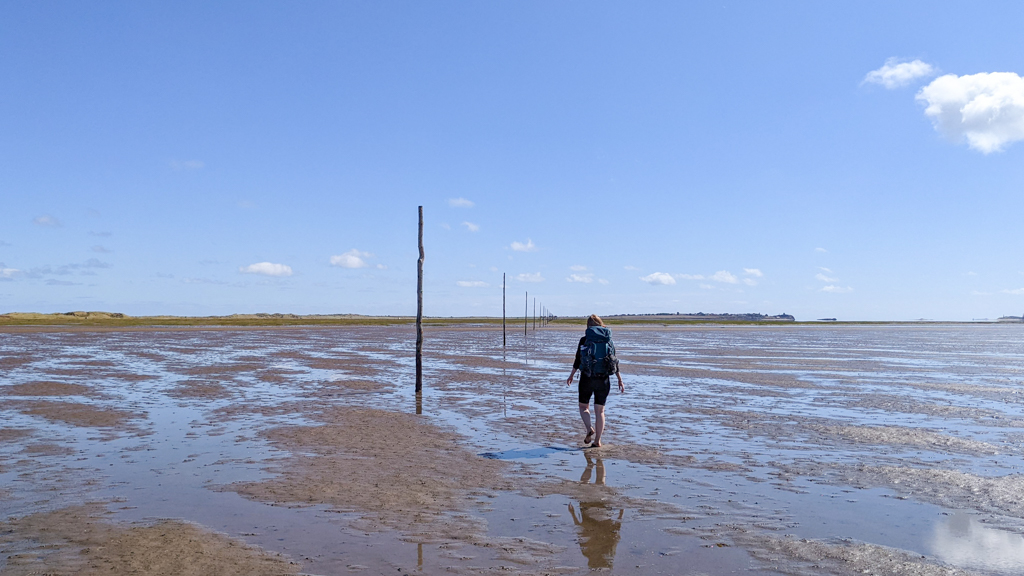
Tips for Walking the Pilgrim’s Way to Lindisfarne
Pilgrim’s Way is a path along the sand from the mainland to the island marked with tall wooden poles and a couple of lookout platforms. It’s around 3.2 miles long and, in our experience, takes anywhere between 75 to 120 minutes to cross.
I’d read as much as I could online about crossing the path including what to wear and when to walk. I really didn’t want to be that stupid tourist who attempted to cross the Pilgrim’s Path and had to call the coastguard to rescue her.
In the end, it worked out very well. We weren’t the first people to attempt the crossing which made us feel more confident. I hooked my hiking boots to my backpack via carabiners (top tip!) and walked barefoot along the sand. We set off around 11:15 (half an hour after the causeway safe crossing began) and, looking at other comments online, this seems ideal.
Walking out to Lindisfarne is better than walking from Lindisfarne to the mainland. And you always want to be walking as the tide is going out, not as it’s coming back in. The water never got higher than our ankles but we often walked on seaweed or muddy, damp sand. It was summer so my feet weren’t cold but I’d recommend water shoes/crocs in spring and autumn and wellies in winter.
Please keep in mind that I’m not an expert in tides or trekking across beaches. But I felt so apprehensive about crossing with all the unhelpful comments I found online. Trust me when I say this: you’ll feel so much more confident and relaxed about crossing once you’re there.


Exploring Lindisfarne and Finishing St Cuthbert’s Way
Bring a wee towel to dust the sand off your feet and put your walking boots on again. You’re on Lindisfarne, baby!
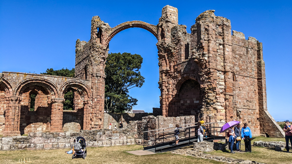
We walked the home stretch along the main road to Lindisfarne Priory which is run by English Heritage so we got in for free. We explored the small on-site museum before heading to the priory ruins and finishing our St Cuthbert’s Way journey at an avant-garde statue of the big guy himself on the grounds. Like the start of St Cuthbert’s Way, there’s no official end marker to the pilgrimage but most walkers consider St Cuthbert’s Statue to be the finish line.
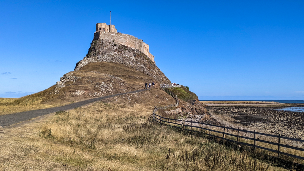
With the few hours we had left, we walked around The Parish Church of Saint Mary the Virgin, Lindisfarne Castle (run by the National Trust) and sat on a beach near the castle. I won’t lie, we visited during the summer holidays so the island was absolutely packed with tourists. I couldn’t believe my eyes when I saw the never-ending stream of cars flocking to the island as we walked along the sands.
But, Lindisfarne is a big island. We found a more secluded area looking out onto the North Sea (and Bamburgh Castle in the distance) to get away from the crowds and reflect on the journey we’d undertaken. I’m sure St Cuthbert would have wanted that for us.


How to Leave Lindisfarne/Holy Island
We wanted to return to Edinburgh that night so we had to leave the island before high tide. We waited at the Holy Island Coach Park bus stop (not the Chare Ends bus stop which Google Maps suggests! Seek it out well before your bus is due to ensure you don’t miss it) for the N.477 bus to Berwick-Upon-Tweed.
This bus generally leaves the island twice a day: once in the morning when the low tide period begins and once in the afternoon around an hour before high tide. Since the bus timetable changes every day, check it and double-check it. Google Maps did actually get the bus times correct, just not the bus stop. There was already a line of people at the bus stop when we arrived half an hour before so get there early.
You can buy a ticket to Berwick-upon-Tweed on the bus via a contactless card. It stops right outside Berwick Railway Station where we hopped on a train back to Edinburgh Waverley Station.

Accommodation on St Cuthbert’s Way Walk
We stayed in a mix of B&Bs and youth hostels on this trip and they were all great. And if you’ve never stayed in a youth hostel before and you’re worried you’re too old, don’t. It’s a complete misnomer because most of the other guests at the hostels we stayed at were decades older than us and we’re pushing 30.
- The Capon Tree Town House in Jedburgh (£83.58 for a private room including a free breakfast basket)
- Friends of Nature SYHA Hostel in Kirk Yetholm (£48 for a private twin room and shared bathroom)
- YHA Hostel & Shepherd’s Huts in Wooler (£47 for a private twin room and shared bathroom)
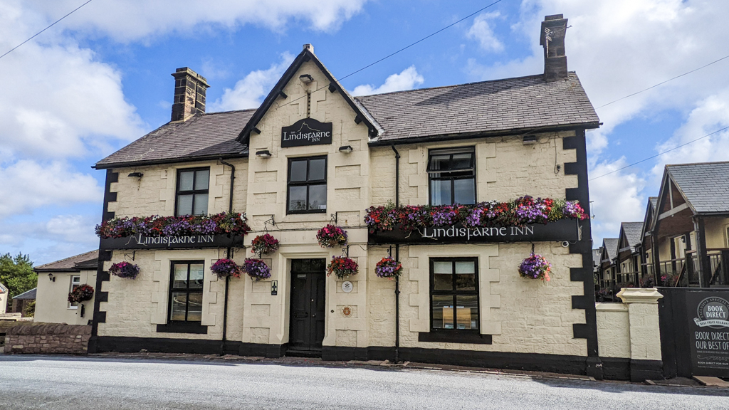
- The Lindisfarne Inn in Beal (£149 for a private room with a great cooked breakfast)
I booked the B&Bs through Booking.com and the hostels direct. I did try and book the Eat and Sleep Lindisfarne Hostel in Beal instead of The Lindisfarne Inn but they were fully booked. Overall, I’m very happy with where we stayed and they were all worth what we paid. The Lindisfarne Inn might’ve cost more money than we would have liked to have paid but it was a really lovely room.


Food and Drink on St Cuthbert’s Way Walk
You need to plan your meals and water intake in advance. There are some sections where you will pass through villages with plenty of supermarkets and pubs and you’ll be grand. But there are other sections where you won’t pass any at all.
I have a 2L Platypus water bladder and a 750ml water bottle that I filled up every morning. This meant I had my entire day’s water intake with me. Even on hot days, I wouldn’t need to worry about drinking enough fluids.
Before leaving Edinburgh, I packed enough veggie jerky, dried fruit, and oaty cereal bars to eat for lunch for the entire trip (excluding Day Five on Lindisfarne). I brought one 20g protein bar and bought others for the rest of the trip at Jedburgh co-op on the morning of Day Two. I picked up some ad hoc lunch bits when the opportunity arose but I had the bare minimum I needed.
Our other meals on St Cuthbert’s Way:
- Day One Breakfast & Dinner: Edinburgh and the Fish & Chip Shop in Jedburgh
- Day Two Breakfast & Dinner: The Capon Tree Town House in Jedburgh and The Borders Hotel in Kirk Yetholm
- Day Three Breakfast & Dinner: The Borders Hotel in Kirk Yetholm and bought food at Wooler co-op and cooked at YHA Hostel
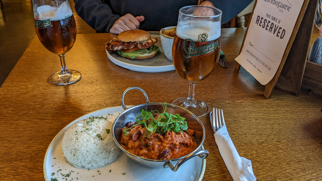
- Day Four Breakfast & Dinner: Bought food at Wooler co-op and ate at the YHA Hostel and The Lindisfarne Inn in Beal
- Day Five Breakfast & Lunch: The Lindisfarne Inn in Beal and 1st Class Food & Post Office Takeaway and Cafe
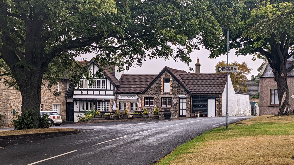
I called The Border Hotel, which was around the corner from our hostel in Kirk Yetholm, earlier that day to reserve a table. It’s a tiny village so they stopped serving food at 19:00. If they were fully booked, we’d have been screwed. Kirk Yetholm has a tiny community store but it was a 15-minute walk away and closed when we arrived. I spoke to the waiter at The Borders Hotel when we ordered dinner to book breakfast for the next morning and it was fine.
We could have also ordered pizza for dinner at YHA Wooler and paid for them to make breakfast for us.


St Cuthbert’s Way Packing List
You already know that we experienced a wide spectrum of weather while hiking this trail (ah Britain, never change!). You’d assume I’d have lots of regrets about what I packed for the trail, but I don’t. I packed more or less the same as when I hiked Hadrian’s Wall Path the September before. I wrote a packing guide for that trip so you can refer to it to see what I took.
In any season, I recommend waterproof walking boots with high ankles. You can expect rain (or wet grass, at least) in any season in this part of the world. Plus, there are lots of steep descents and rocky paths so you should opt for ankle protection too.
Don’t pack cotton or any other fabrics that will smell after one wash. Pack clothing made from technical fabrics like merino wool that you can wear again and again.
Read next: Hadrian’s Wall Path Packing List for Women
So, Would I recommend Walking St Cuthbert’s Way?
I’ll admit that walking St Cuthbert’s Way was more difficult than I expected. After walking for six days on Hadrian’s Wall Path, I thought four days would be a piece of cake. But there’s much more elevation on St Cuthbert’s and the crazy weather fluctuations were tough.
BUT! It was a fantastic challenge and I pushed myself more mentally and physically than I have in a while. I loved visiting the abbeys on Day One and walking through the heather on Day Three. Plus, there is something really magical about arriving at Lindisfarne after walking for all that time.
I would recommend walking St Cuthbert’s Way if you love history, hill walking and have a reasonable fitness level. Walk between April – October so you’re not starting or finishing the walk in the dark and it’s not too cold. And if you’re walking St Cuthbert’s Way alone then you will absolutely get the solitude that Cuthbert would have enjoyed on his own journey all those centuries ago.

And that’s my St Cuthbert’s Way guide based on my personal experience! Have you heard of St Cuthbert’s Way? Do you want to hike it yourself? Let me know in the comments below!
Read next: Hadrian’s Wall Walk: Essential Tips To Know Before You Set Off
Rebecca- thank you for this detailed outline!! Did you carry all of your gear/clothes with or did you have everything shuttled ahead for you?
Hi Rose! Yes, I carried all of my gear and clothes with me. I packed almost the exact same stuff that I took when hiking Hadrian’s Wall: https://almostginger.com/hadrians-wall-path-packing-list/.
But there are lots of companies listed on this site that offer shuttle services: https://www.stcuthbertsway.info/services/baggage-transfer/#77-slide-3
Hi Rebecca. Really appreciate your blog here. Very interesting and informative. I did Hadrians Wall last year with a bunch of mates and one the things we liked were the little tea shacks that various farmers and locals had set up along the way. I wondered if you encountered any similar places along St Cuthbert’s Way. We’re doing it in May.
Thanks
Thanks so much for your comment, Kevan! Coincidentally, I also walked Hadrian’s Wall Path before I did St Cuthbert’s Way. Unfortunately, there are absolutely no honesty boxes or anything of the kind on St Cuthbert’s Way, at least not when I did it in August last year. On the first two legs, you do pass through a couple of towns with little corner shops, but on the third and fourth legs, you’re well in the national park and woodland areas rather than farmland so I wouldn’t expect to see anything.
Hi Rebecca. What an excellent and professional account of your trip. I am just in the process now of booking to do St. Cuthberts Way in April and am looking forward to it all the more having read your account. I am walking it over 6 days ( being more than twice your age!) staying at inns, b&b’s etc. I did the West Highland Way earlier this year and the Great Glen last year and would recommend them both highly to you if you haven’t already done them.
Thanks so much for your comment Bob, I’m sure you’ll love St Cuthbert’s Way! Ahh I haven’t done these, I definitely have my eye on the West Highland Way but I’ll have to look into the Great Glen too! I’ve walked Hadrian’s Wall Path and I loved it so I definitely want to do more 🙂 All the best for your hike!